About Our Village
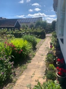
 Crazelowman is a pretty hamlet of 17 homes, three listed, surrounded by fields some of which have been under the careful stewardship of the same farming family for more than 50 years. There are sheep and cattle to be found here along with seasonal crops and some beautiful walks. The farming calendar still governs the rhythm and activities of life – even for those who are not farmers. The Old Mill played a central part in days gone powered by a series of leats and watercourses which in turn irrigated and fertilised the land. The mill discharged into the river Lowman which flows at the foot of the hamlet.
Crazelowman is sometimes seen spelt as Craze Lowman, two separate words. Both spellingsare acceptable although increasingly, we are Crazelowman. For much of its history Craze Lowman, was also sometimes known as Lowman Claville, formed a manor within the large parish of Tiverton. Crazelowman was part of the Chevithorne estate until 1905.
History
Stone age links:
The Crazelowman area is the location of some of the most intensive prehistoric activity in the Tiverton area (as represented by finds of flint and chert tools), especially in the Mesolithic and Neolithic periods. We have a bronze Age Bowl which is just visible on the left-hand side as you enter the hamlet, north of the 361. The only formal archaeological activity to have taken place was at Higher Craze Lowman Farm in 2008, this revealed a post-medieval rubbish pit and there are others close by. These sites are known from cropmarks detected by aerial photography showing the attraction of the Lowman valley to settlers and agriculturalists of early periods – you can find out more on The Devon Historic Environment Record (HER), accessed through the Heritage Gateway website
Waterpower
The hydrology of the area is interesting and complex, with two main purposes driving it in the medieval and post- medieval periods: the provision of waterpower to the mill and the system of water-meadow management in the valley bottom the net effect of the many leats and spillways that they produced is to surround the wider hamlet, with watercourses.
